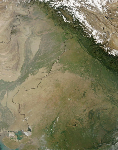
Sary:Thar Desert satellite.jpg

Haben'ny topi-maso: 471 × 599 teboka. Habe hafa: 189 × 240 teboka | 500 × 636 teboka
Rakitra niaviana (500 × 636 teboka, haben'ilay rakitra : 329 kio, endrika MIME : image/jpeg)
Tantara ny rakitra
Tsindrio eo amin'ny daty/ora iray mba hijery ny toetra n'ilay rakitra tamin'io fotoana io.
| Daty sy ora | saritapaka | Habe | Mpikambana | resaka | |
|---|---|---|---|---|---|
| ankehitriny | 17 Septambra 2005 à 14:25 |  | 500 × 636 (329 kio) | Crux | Satellite Image of Thar Desert, India/Pakistan (border line in the middle) from en:, uploaded by en:User:Tom Radulovich |
Fampiasana an'io rakitra io
Mampiasa ity rakitra ity io pejy io:
Fampiasan-drakitra maneran-tontolo
Mampiasa ity rakitra ity ireo wiki hafa ireo:
- Fampiasana eo amin'i ar.wikipedia.org
- Fampiasana eo amin'i az.wikipedia.org
- Fampiasana eo amin'i bg.wikipedia.org
- Fampiasana eo amin'i bn.wikipedia.org
- Fampiasana eo amin'i bs.wikipedia.org
- Fampiasana eo amin'i ckb.wikipedia.org
- Fampiasana eo amin'i de.wikipedia.org
- Fampiasana eo amin'i en.wikipedia.org
- Fampiasana eo amin'i eo.wikipedia.org
- Fampiasana eo amin'i es.wikipedia.org
- Fampiasana eo amin'i et.wikipedia.org
- Fampiasana eo amin'i fa.wikipedia.org
- Fampiasana eo amin'i fi.wikipedia.org
- Fampiasana eo amin'i fr.wikipedia.org
- Fampiasana eo amin'i he.wikipedia.org
- Fampiasana eo amin'i hu.wikipedia.org
- Fampiasana eo amin'i it.wikipedia.org
- Fampiasana eo amin'i ja.wikipedia.org
- Fampiasana eo amin'i ka.wikipedia.org
- Fampiasana eo amin'i kk.wikipedia.org
- Fampiasana eo amin'i kn.wikipedia.org
- Fampiasana eo amin'i ko.wikipedia.org
- Fampiasana eo amin'i ky.wikipedia.org
- Fampiasana eo amin'i lfn.wikipedia.org
- Fampiasana eo amin'i lt.wikipedia.org
- Fampiasana eo amin'i mai.wikipedia.org
- Fampiasana eo amin'i mk.wikipedia.org
- Fampiasana eo amin'i ml.wikipedia.org
- Fampiasana eo amin'i mr.wikipedia.org
- Fampiasana eo amin'i ms.wikipedia.org
- Fampiasana eo amin'i ne.wikipedia.org
- Fampiasana eo amin'i nn.wikipedia.org
- Fampiasana eo amin'i pa.wikipedia.org
- Fampiasana eo amin'i pl.wikipedia.org
- Fampiasana eo amin'i pnb.wikipedia.org
- Fampiasana eo amin'i pt.wikipedia.org
Hijery fampiasana eran-terikasan'ity rakitra ity.

