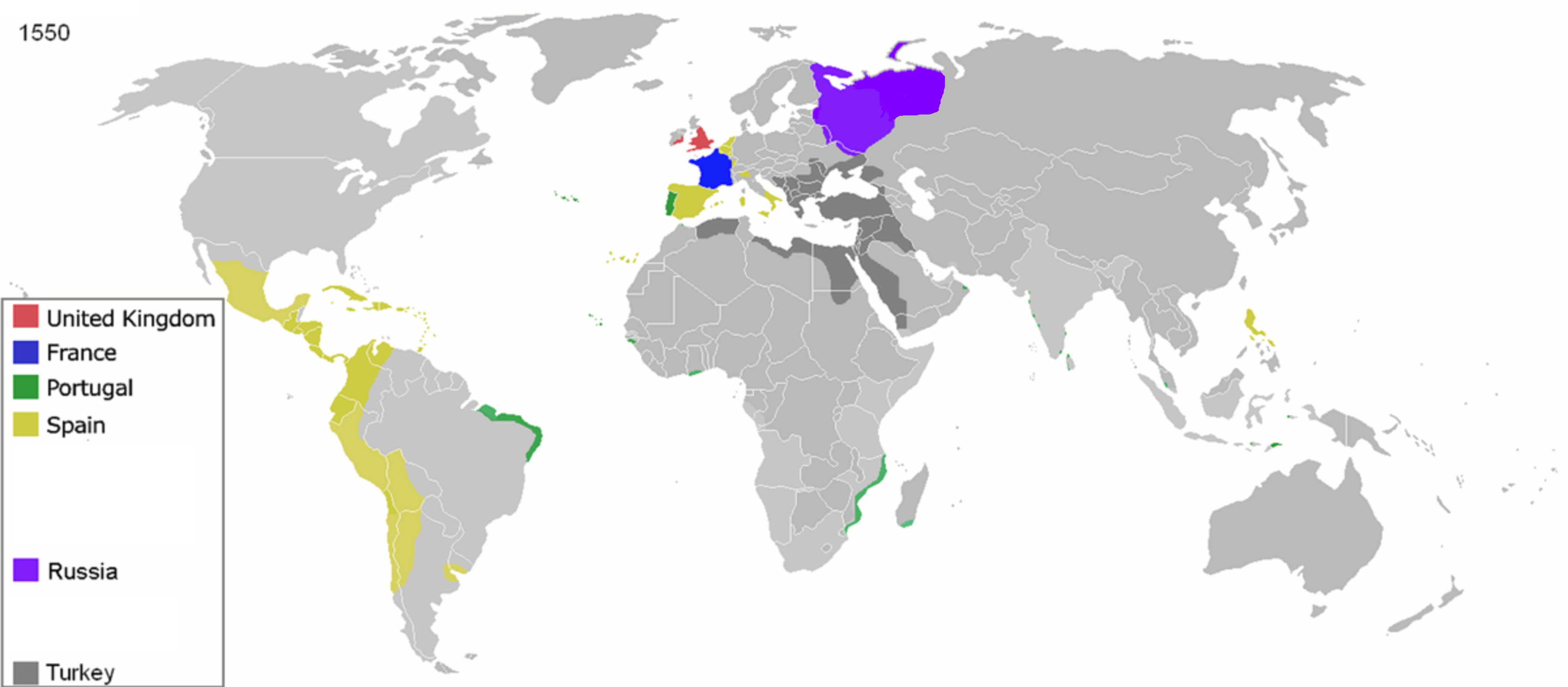
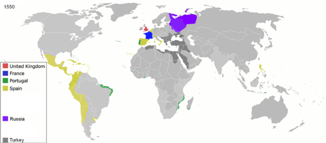
Sary:Colonisation 1550.png
Rakitra niaviana (3 600 × 1 578 teboka, haben'ilay rakitra : 1,14 Mio, endrika MIME : image/png)
| Visavisa |
Map of major world powers by year
As the orriginal licence of the animation was Public Domain, this image which has been derived from it is too:
|
||||||||||||||||||
| Daty | |||||||||||||||||||
| Loharano | public domain animated map by ArdadN here | ||||||||||||||||||
| Mpamorona azy | ArdadN | ||||||||||||||||||
.jpg)
._LOC_2001620596.jpg)

|
Cette image (de type historical map) devrait être recréée dans un format vectoriel, en tant que fichier SVG. Cela offrirait plusieurs avantages : voir Commons:Media for cleanup pour plus d'informations. Si une version SVG de cette image est déjà disponible, merci de bien vouloir l'envoyer. Après cela, remplacez ce modèle par {{vector version available|nouveau nom d'image.svg}}.
|
Tantara ny rakitra
Tsindrio eo amin'ny daty/ora iray mba hijery ny toetra n'ilay rakitra tamin'io fotoana io.
| Daty sy ora | saritapaka | Habe | Mpikambana | resaka | |
|---|---|---|---|---|---|
| ankehitriny | 26 Aprily 2020 à 11:32 | | 3 600 × 1 578 (1,14 Mio) | Ориенталист | Clarified the territory of Russia by 1550 |
| 5 Aprily 2020 à 09:25 |  | 3 600 × 1 578 (1,14 Mio) | Ориенталист | cosmetic changes | |
| 27 Martsa 2020 à 14:55 |  | 4 275 × 1 875 (1,05 Mio) | Ориенталист | Clarified the territory of Russia. | |
| 3 Mey 2010 à 23:25 |  | 1 425 × 625 (73 kio) | Kieran4 | Fixed errors. | |
| 22 Martsa 2007 à 10:40 |  | 1 425 × 625 (65 kio) | Roke~commonswiki | {{Information |Description=Map of major world powers by year {{Maps of world history}} As the orriginal licence of the animation was Public Domain, this image which has been derived from it is too: {{PD-User|Andrei nacu}} |Source=public domain animated m |
Fampiasana an'io rakitra io
Mampiasa ity rakitra ity io pejy io:
Fampiasan-drakitra maneran-tontolo
Mampiasa ity rakitra ity ireo wiki hafa ireo:
- Fampiasana eo amin'i af.wikipedia.org
- Fampiasana eo amin'i ast.wikipedia.org
- Fampiasana eo amin'i bn.wikipedia.org
- Fampiasana eo amin'i bs.wikipedia.org
- Fampiasana eo amin'i cs.wikipedia.org
- Fampiasana eo amin'i de.wikipedia.org
- Fampiasana eo amin'i en.wikipedia.org
- Fampiasana eo amin'i es.wikipedia.org
- Fampiasana eo amin'i fa.wikipedia.org
- Fampiasana eo amin'i fr.wikipedia.org
- Fampiasana eo amin'i he.wikipedia.org
- Fampiasana eo amin'i kk.wikipedia.org
- Fampiasana eo amin'i no.wikipedia.org
- Fampiasana eo amin'i pt.wikipedia.org
- Fampiasana eo amin'i sk.wikipedia.org