BlankMap-Europe.png(450 × 422 teboka, haben'ilay rakitra : 15 kio, endrika MIME : image/png)

Avy amin'i Wikimedia Commons io rakitra io ary mety ampiasain'ny tetikasa hafa. Aseho eo ambany ny famisavisana ilay rakitra.

Une version vectorielle de cette image existe, dans le format « SVG ». Si elle n’est pas inférieure, elle devrait être utilisée à la place de la présente version pour des affichages en plus grandes dimensions ou nécessitant une meilleure résolution.

File:BlankMap-Europe.png → File:Blank map of Europe cropped.svg

Pour plus d’informations sur les images vectorielles, consultez la page de transition de Commons vers le format SVG.
Voir aussi les informations à propos de la manière dont le logiciel MediaWiki gère les images au format SVG.

Dans les autres langues
Alemannisch  Bahasa Indonesia  Bahasa Melayu  British English  català  čeština  dansk  Deutsch  eesti  English  español  Esperanto  euskara  français  Frysk  galego  hrvatski  Ido  italiano  lietuvių  magyar  Nederlands  norsk bokmål  norsk nynorsk  occitan  Plattdüütsch  polski  português  português do Brasil  română  Scots  sicilianu  slovenčina  slovenščina  suomi  svenska  Tiếng Việt  Türkçe  vèneto  Ελληνικά  беларуская (тарашкевіца)  български  македонски  нохчийн  русский  српски / srpski  татарча/tatarça  українська  ქართული  հայերեն  বাংলা  தமிழ்  മലയാളം  ไทย  한국어  日本語  简体中文  繁體中文  עברית  العربية  فارسی  +/−
Nouvelle image SVG

Ambangovangony

Visavisa
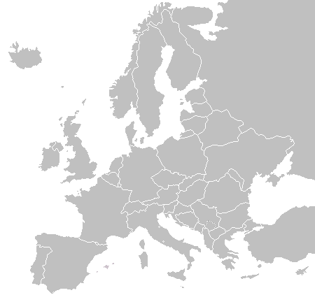
English: A blank political map of Europe as of 2004 (updated 2006 and 2008), made by the uploader for Wikipedia.
The list of independent states pictured on the map (source): Albania, Andorra, Austria, Belarus, Belgium, Bosnia and Herzegovina, Bulgaria, Croatia, Czech Republic, Cyprus, Denmark, Estonia, Finland, France, Germany, Greece, Hungary, Iceland, Ireland, Italy, Latvia, Liechtenstein, Lithuania, Luxembourg, Kosovo (disputed), Macedonia, Moldova, Monaco, Montenegro, Netherlands, Norway, Poland, Portugal, Romania, Russia, San Marino, Serbia, Slovakia, Slovenia, Spain, Sweden, Switzerland, Turkey, Ukraine, United Kingdom, Vatican City
Daty 16 Novambra 2003 (date de téléversement originale)
Loharano Asan'ny tena
Mpamorona azy Vardion sur Wikipedia Anglisy

Navoaka tambanin'ny lisansy

Public domain Moi, propriétaire des droits d’auteur sur cette œuvre, la place dans le domaine public. Ceci s'applique dans le monde entier.
Dans certains pays, ceci peut ne pas être possible ; dans ce cas :
J’accorde à toute personne le droit d’utiliser cette œuvre dans n’importe quel but, sans aucune condition, sauf celles requises par la loi.

Laogin'ny fampidirana loharano

The original description page was here. All following user names refer to en.wikipedia.
  • 2006-06-10 12:08 Astrokey44 422×422 (10216 bytes) montenegro independent
  • 2006-04-23 18:32 Lgriot 450×422 (7164 bytes) Reverted to earlier revision
  • 2006-04-23 18:32 Lgriot 415×422 (9421 bytes) Reverted to earlier revision
  • 2006-02-22 07:01 BionicWilliam 450×422 (9812 bytes) Reverted to earlier revision
  • 2006-02-22 07:01 BionicWilliam 415×422 (9421 bytes) Reverted to earlier revision
  • 2006-01-04 08:52 E Pluribus Anthony 450×422 (9812 bytes) Blank map of Europe (2005)
  • 2005-09-22 18:14 E Pluribus Anthony 450×422 (9805 bytes) Blank map of Europe (2005)
  • 2005-09-19 09:15 E Pluribus Anthony 450×422 (9804 bytes) Blank map of Europe, 2005
  • 2005-09-19 06:45 E Pluribus Anthony 450×422 (7164 bytes) Blank map of Europe
  • 2005-07-21 05:05 MishaChan 415×422 (5477 bytes) Reverted to earlier revision
  • 2005-07-21 05:04 MishaChan 415×422 (9421 bytes) Reverted to earlier revision
  • 2005-01-22 16:48 Richie 415×422 (5477 bytes) modified Ireland (border), Orkney, Shetlands
  • 2004-09-07 10:53 Gobnuts 415×422 (9421 bytes) Reverted to earlier revision
  • 2004-09-07 10:51 Gobnuts 415×422 (9410 bytes) Reverted to earlier revision
  • 2003-11-16 08:07 Vardion 415×422 (9421 bytes) Blank map of Europe (corrected again)
  • 2003-11-16 08:04 Vardion 415×422 (9410 bytes) Blank map of Europe (corrected)
  • 2003-11-16 07:16 Vardion 415×430 (9113 bytes) Blank map of Europe

Légendes

Ajoutez en une ligne la description de ce que représente ce fichier

Éléments décrits dans ce fichier

dépeint Frantsay

16 Novambra 2003

type MIME Frantsay

image/png

fd8d2f1165f0bd5741de4e44d0bdfd3444feb56e

méthode de détermination Frantsay : SHA-1 Frantsay

14 906 octet

hauteur Frantsay

422 pixel

largeur Frantsay

450 pixel

Tantara ny rakitra

Tsindrio eo amin'ny daty/ora iray mba hijery ny toetra n'ilay rakitra tamin'io fotoana io.

(vaovao indrindra | antitra indrindra) Hijery (10 vao haingana | ) (10 | 20 | 50 | 100 | 250 | 500).
Daty sy orasaritapakaHabeMpikambanaresaka
ankehitriny23 Septambra 2015 à 22:02Vignette ho an'ny 23 Septambra 2015 à 22:02450 × 422 (15 kio)OgreBot(BOT): Reverting to most recent version before archival
23 Septambra 2015 à 22:02Vignette ho an'ny 23 Septambra 2015 à 22:02450 × 422 (10 kio)OgreBot(BOT): Uploading old version of file from en.wikipedia; originally uploaded on 2006-01-04 08:52:21 by E Pluribus Anthony
23 Septambra 2015 à 22:02Vignette ho an'ny 23 Septambra 2015 à 22:02450 × 422 (10 kio)OgreBot(BOT): Uploading old version of file from en.wikipedia; originally uploaded on 2005-09-22 18:14:10 by E Pluribus Anthony
23 Septambra 2015 à 22:02Vignette ho an'ny 23 Septambra 2015 à 22:02450 × 422 (10 kio)OgreBot(BOT): Uploading old version of file from en.wikipedia; originally uploaded on 2005-09-19 09:15:43 by E Pluribus Anthony
23 Septambra 2015 à 22:02Vignette ho an'ny 23 Septambra 2015 à 22:02450 × 422 (7 kio)OgreBot(BOT): Uploading old version of file from en.wikipedia; originally uploaded on 2005-09-19 06:45:22 by E Pluribus Anthony
23 Septambra 2015 à 22:02Vignette ho an'ny 23 Septambra 2015 à 22:02415 × 422 (5 kio)OgreBot(BOT): Uploading old version of file from en.wikipedia; originally uploaded on 2005-01-22 16:48:46 by Richie
23 Septambra 2015 à 22:01Vignette ho an'ny 23 Septambra 2015 à 22:01415 × 422 (9 kio)OgreBot(BOT): Uploading old version of file from en.wikipedia; originally uploaded on 2003-11-16 08:04:27 by Vardion
23 Septambra 2015 à 22:01Vignette ho an'ny 23 Septambra 2015 à 22:01415 × 430 (9 kio)OgreBot(BOT): Uploading old version of file from en.wikipedia; originally uploaded on 2003-11-16 07:16:14 by Vardion
21 Jolay 2009 à 19:27Vignette ho an'ny 21 Jolay 2009 à 19:27450 × 422 (15 kio)Hoshiefixed Montenegro
18 Jolay 2009 à 08:20Vignette ho an'ny 18 Jolay 2009 à 08:20450 × 422 (15 kio)Hoshieredid Kosovo/Montenegro borders based on an older version of File:Continental-Europe-map.png; anti-aliasing has been removed.
(vaovao indrindra | antitra indrindra) Hijery (10 vao haingana | ) (10 | 20 | 50 | 100 | 250 | 500).

Tsy misy pejy mampiasa an'ity rakitra ity.

Fampiasan-drakitra maneran-tontolo

Mampiasa ity rakitra ity ireo wiki hafa ireo:

Metadata